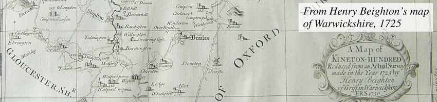

Barcheston parish lies in south Warwickshire, covering 1555 acres (629 hectares). There are two settlements, Barcheston, where the church, rectory, manor house and mill are sited, and Willington.
The western boundary of the parish is formed by the river Stour from which the land boundary describes a half-circle. As far as possible the boundary follows the highest ground, returning to the river just north of the bridge across the Stour leading into Shipston. Seen from the west side of the valley the parish clearly occupies rising ground with three slightly higher points running north-south, only one of which is now named – Borough Hill (94 m.) to the north. Its medieval name was Barrow or Burrow Hill.
To the south lie Bean Hill (100 m) and its southern neighbour, probably the medieval Windmill Hill (95m) on which metal detecting regularly turns up a scattering of small finds. The dip between the two, the route of a modern footpath, marks the boundary between the two medieval settlements. Eastwards the ground rises to the bulk of Brailes Hill (232 m) which overlooks the parish and is a landmark for miles around. Yet the two settlements were sited at the lowest point only just above the river bank, Barcheston to the north, Willington to the south, at a height of approximately 90 m.
The river’s flow was once sufficient to power a mill, situated in Barcheston. Fifteenth century documents indicate the existence also of a windmill, possibly in Willington.
